City of Stanwood BOUNDARY LINE ADJUSTMENT CHECKLIST - ci stanwood wa Preview on Page 1

City of Stanwood BOUNDARY LINE ADJUSTMENT CHECKLIST - ci stanwood wa 2026

Here's how it works

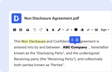
  • 01. Edit your form online

    Type text, add images, blackout confidential details, add comments, highlights and more.

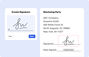
  • 02. Sign it in a few clicks

    Draw your signature, type it, upload its image, or use your mobile device as a signature pad.

  • 03. Share your form with others

    Send it via email, link, or fax. You can also download it, export it or print it out.

How to use or fill out City of Stanwood BOUNDARY LINE ADJUSTMENT CHECKLIST - ci stanwood wa

Form edit decoration
9.5
Ease of Setup
DocHub User Ratings on G2
9.0
Ease of Use
DocHub User Ratings on G2
  1. Click ‘Get Form’ to open it in the editor.
  2. Begin by entering the 'Project Name' at the top of the checklist. This identifies your application.
  3. In the 'Documents' section, check off each required item as you gather them. Ensure you have a complete Master Permit Application and fee ready for submission.
  4. For the vicinity map, upload a clear image that assists in locating your boundary line adjustment.
  5. Prepare four copies of the Title Insurance Report along with Plat Certificates, ensuring they are dated within 90 days prior to submission.
  6. Collect notarized agreements from property owners consenting to the boundary adjustments and include them in your submission.
  7. For maps/drawings, ensure five legible copies are prepared according to specified requirements, including title blocks and certification from a land surveyor.

Start using our platform today to streamline your document editing and form completion for free!

See more City of Stanwood BOUNDARY LINE ADJUSTMENT CHECKLIST - ci stanwood wa versions

We've got more versions of the City of Stanwood BOUNDARY LINE ADJUSTMENT CHECKLIST - ci stanwood wa form. Select the right City of Stanwood BOUNDARY LINE ADJUSTMENT CHECKLIST - ci stanwood wa version from the list and start editing it straight away!

VersionsForm popularityFillable & printable
20144 Satisfied (30 Votes)

be ready to get more

Complete this form in 5 minutes or less

Got questions?

We have answers to the most popular questions from our customers. If you can't find an answer to your question, please contact us.

In the case of a Boundary Line Adjustment, sometimes also referred to as a Lot Line Adjustment, the jurisdiction is with the local planning authority, either the county or city in which the property lies.
Pattern adjustment lines are indicators that help sewers shorten or lengthen a piece. They usually appear as two parallel lines, each on a separate piece of the template. They are adjusted to match up, overlap. or move away from one another based on the lengthening or shortening desired by the sewer.
A boundary line adjustment (BLA) is intended for the purpose of altering the location of property lines in order to reflect existing physical boundaries or to make minor changes to lot lines. BLAs are a minor alteration in the location of lot boundaries on existing lots.
Lot line adjustments, also known as boundary line adjustments or property line adjustments, are legal processes that allow property owners to modify the boundaries of their adjacent parcels without creating entirely new lots.

Security and compliance

At DocHub, your data security is our priority. We follow HIPAA, SOC2, GDPR, and other standards, so you can work on your documents with confidence.

Related links

West Stanwood and the 100-Year Floodplain: Exploring Costs

Based on the research conducted, there are several recommendations that include conducting a new floodplain survey, creating useable maps for residents,Read more

Learn more
City of Stanwood

Jun 11, 2015 City of Stanwoods municipal boundaries on the west, south, and east. an assessed valuation of $848,300. BOUNDARY SECTION LINE PROPERTY

Learn more
If you believe that this page should be taken down, please follow our DMCA take down process here