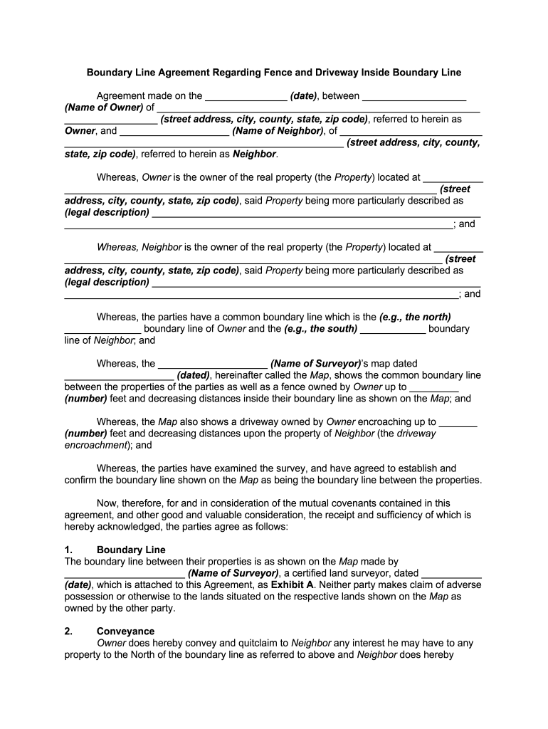


Definition and Meaning of Boundary Line Property
A boundary line property refers to the demarcation between two parcels of land, often established to clarify property ownership and use. This line can be formalized through a legal document known as a Boundary Line Agreement, typically involving both property owners. The agreement ensures both parties have a clear understanding of their property limits, preventing potential disputes over land usage or ownership rights. For example, if a homeowner wishes to install a fence or build a structure near their property line, the boundary line provides a precise reference point for planning and construction.
How to Use the Boundary Line Property
Using a boundary line property accurately involves several key steps. First, it is essential to refer to a detailed survey map, which outlines the property's boundaries as agreed upon by both owners. This map acts as a visual guide during property development or maintenance activities. Homeowners can also use this information to address any encroachments or resolve disputes amicably. For instance, if a new driveway is being planned, both owners can agree on its location, ensuring it stays within the designated boundaries and complies with local zoning laws.
How to Obtain the Boundary Line Property Agreement
Securing a boundary line property agreement requires collaboration between the involved parties and often, legal consultants. Here’s a recommended process for obtaining such an agreement:
- Conduct a Professional Survey: Hire a licensed surveyor to accurately identify and map the property lines.
- Consult Legal Counsel: Engage with a property attorney to draft a formal agreement based on the survey's findings.
- Negotiate Terms: Both parties discuss and agree on the terms, including any shared responsibilities or adjustments needed.
- Finalize the Document: Sign the agreement in the presence of witnesses, as required by state law, and ensure it is recorded with the local land registry office.
Steps to Complete the Boundary Line Property Agreement
Completing a boundary line property agreement involves several necessary steps, each crucial to the final document's legal standing:
- Gather Necessary Information: Collect all existing property deeds, prior surveys, and maps.
- Draft Agreement: Draft the agreement including all specifics of the boundary line, legal descriptions, and any special conditions.
- Review and Adjust: Both parties, along with legal counsel, review the document for accuracy and completeness.
- Signature and Notarization: Ensure both parties sign the agreement in front of a notary public to authenticate the document.
- Record the Agreement: File the finalized and notarized agreement with the county registrar to make it a part of the official property records.
Why You Should Define Your Boundary Line Property
Defining the boundary line property is crucial for several reasons:
- Prevent Disputes: Clearly defined property lines help prevent disagreements between neighbors over land use and ownership.
- Enhance Property Value: Well-established boundaries can increase a property's market value by eliminating uncertainties for potential buyers.
- Legal Compliance: Accurate boundaries ensure compliance with local zoning laws and building codes, reducing the risk of legal penalties.
Important Terms Related to Boundary Line Property
Understanding critical terms related to boundary line property is beneficial:
- Encroachment: Unauthorized intrusion of one property onto another, such as a fence or building.
- Easement: A legal right to use another's land for a specific limited purpose, like access to a driveway or utilities.
- Adverse Possession: A situation where someone may claim ownership of land after occupying it for a certain period, under specific conditions.
Legal Use of the Boundary Line Property
The legal use of a boundary line property ensures compliance with the law and protects property rights. Here are some considerations:
- Adhering to Zoning Laws: Boundary delineations must respect zoning restrictions to avoid penalties.
- Settling Disputes: Use the established line to resolve conflicts over land use or encroachments legally.
- Documenting Adjustments: Any adjustments to boundaries must be documented and legally recorded to maintain clarity and avoid future issues.
Examples of Using Boundary Line Property
Examples illustrate the practical use of boundary line properties:
- Boundary Demarcation for Fences: A homeowner planning to build a fence can refer to the boundary line to ensure it is built within property limits.
- Resolving Encroachments: If a neighbor's shed crosses into another property, the boundary line can act as an objective basis for resolving the issue.
- Real Estate Transactions: During property sales, accurate boundary lines are essential for transparency and completing the transaction smoothly.