Related links
2019 State of U.S. High Tide Flooding with a 2020 Outlook
by WWVV Sweet 2020 Cited by 12 The Center provides the set of water level and tidal current products required to support NOS Strategic Plan mission requirements, and to assist in providing
Learn more
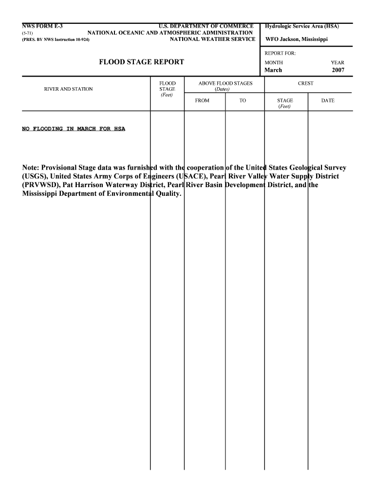
National Weather Service
Heavy Rainfall for Portions of the West and Central U.S.; Monitoring Fire Weather Conditions for New England ; Flood Warning Severe Thunderstorm Watch Gale
Learn more
S P E C I A L R E P O R T
When an atmospheric river makes landfall, extreme precipitation and flooding can often result. The cover features a natural-color image of conditions over the
Learn more