Type text, add images, blackout confidential details, add comments, highlights and more.
02. Sign it in a few clicks
Draw your signature, type it, upload its image, or use your mobile device as a signature pad.
03. Share your form with others
Send wetlands freshwater via email, link, or fax. You can also download it, export it or print it out.
How to use or fill out wetland west region with our platform
Ease of Setup
DocHub User Ratings on G2
Ease of Use
DocHub User Ratings on G2
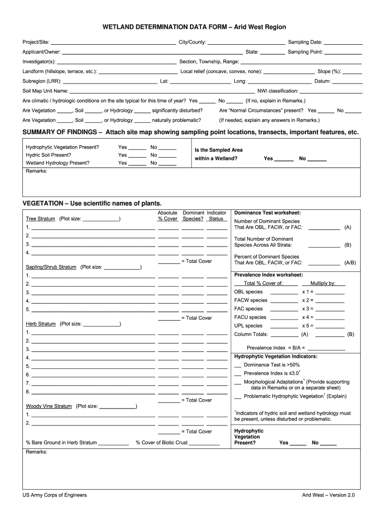
Click ‘Get Form’ to open the wetland west region document in the editor.
Begin by filling in the 'City/County' and 'Project/Site' fields. This information is crucial for identifying the specific location of your wetland assessment.
Next, enter the 'Sampling Date', 'State', and details about the 'Applicant/Owner' and 'Investigator(s)'. Accurate data here ensures proper documentation.
Proceed to complete the sections on landform, local relief, latitude, longitude, and NWI classification. These fields help define the physical characteristics of your site.
In the hydrology section, indicate whether hydrophytic vegetation, hydric soil, and wetland hydrology are present by selecting 'Yes' or 'No'. Provide remarks if necessary.
Finally, review all entries for accuracy before saving or exporting your completed form. Utilize our platform's features to ensure a smooth workflow.
Start using our platform today to simplify your wetland assessments for free!
Wetland west region animalsIndiana Wetlands MapWetland west region climateIndiana Wetlands AssociationLimberlost SwampDeniston Natural Resource AreaCan you hunt Nature preserves in IndianaIDEM wetlands
Security and compliance
At DocHub, your data security is our priority. We follow HIPAA, SOC2, GDPR, and other standards, so you can work on your documents with confidence.
THE WESTERN REGION IS HOME TO SOME. OF THE RICHEST AND MOST DIVERSE COASTAL WETLANDS AREAS IN. GHANA AND YET THERE ARE NO FORMAL MECHANISMS FOR THEIR.Read more
Cookie consent notice
This site uses cookies to enhance site navigation and personalize your experience.
By using this site you agree to our use of cookies as described in our Privacy Notice.
You can modify your selections by visiting our Cookie and Advertising Notice.