Type text, add images, blackout confidential details, add comments, highlights and more.
02. Sign it in a few clicks
Draw your signature, type it, upload its image, or use your mobile device as a signature pad.
03. Share your form with others
Send it via email, link, or fax. You can also download it, export it or print it out.
How to use or fill out elevation certificate 2012 form with our platform
Ease of Setup
DocHub User Ratings on G2
Ease of Use
DocHub User Ratings on G2
Click ‘Get Form’ to open the elevation certificate 2012 form in the editor.
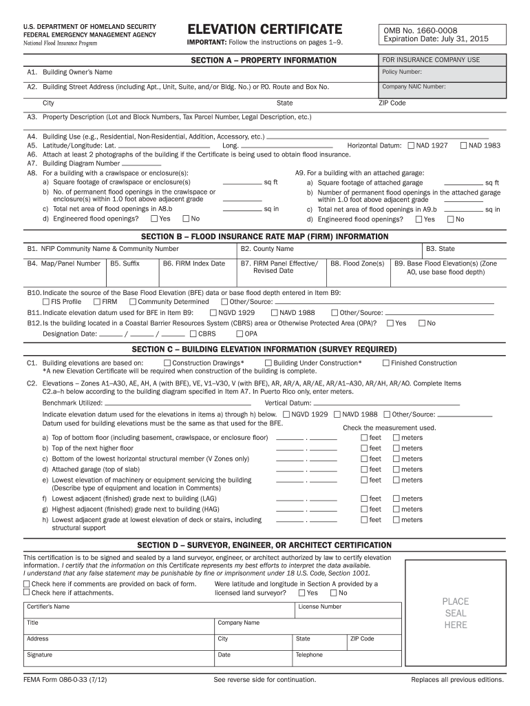
Begin with Section A, where you will input the property information. Fill in the building owner's name, address, and policy number accurately.
In Section B, provide details regarding the Flood Insurance Rate Map (FIRM) information. Ensure to include community name, county name, and flood zone.
Proceed to Section C for building elevation information. Enter all required elevations based on your survey data, ensuring consistency with the base flood elevation data.
Complete Section D by having a licensed surveyor or engineer certify the information. This section requires their signature and seal.
If applicable, attach photographs of the building as specified in Section A8. Use our platform's features to easily upload and position these images.
Start filling out your elevation certificate today for free using our platform!
Fill out elevation certificate 2012 form online It's free
We've got more versions of the elevation certificate 2012 form form. Select the right elevation certificate 2012 form version from the list and start editing it straight away!
This certification is to be signed and sealed by a land surveyor, engineer, or architect authorized by law to DocHub elevation information. I DocHub that theRead more
Summary of Technical Impracticability Waivers at National
The purpose of this report is to provide a summary of. Technical Impracticability (TI) waivers that have been issued by U.S. Environmental Protection Agency.Read more
Cookie consent notice
This site uses cookies to enhance site navigation and personalize your experience.
By using this site you agree to our use of cookies as described in our Privacy Notice.
You can modify your selections by visiting our Cookie and Advertising Notice.