Type text, add images, blackout confidential details, add comments, highlights and more.
02. Sign it in a few clicks
Draw your signature, type it, upload its image, or use your mobile device as a signature pad.
03. Share your form with others
Send it via email, link, or fax. You can also download it, export it or print it out.
How to use or fill out Utah Formation with our platform
Ease of Setup
DocHub User Ratings on G2
Ease of Use
DocHub User Ratings on G2
Click ‘Get Form’ to open the Utah formation document in the editor.
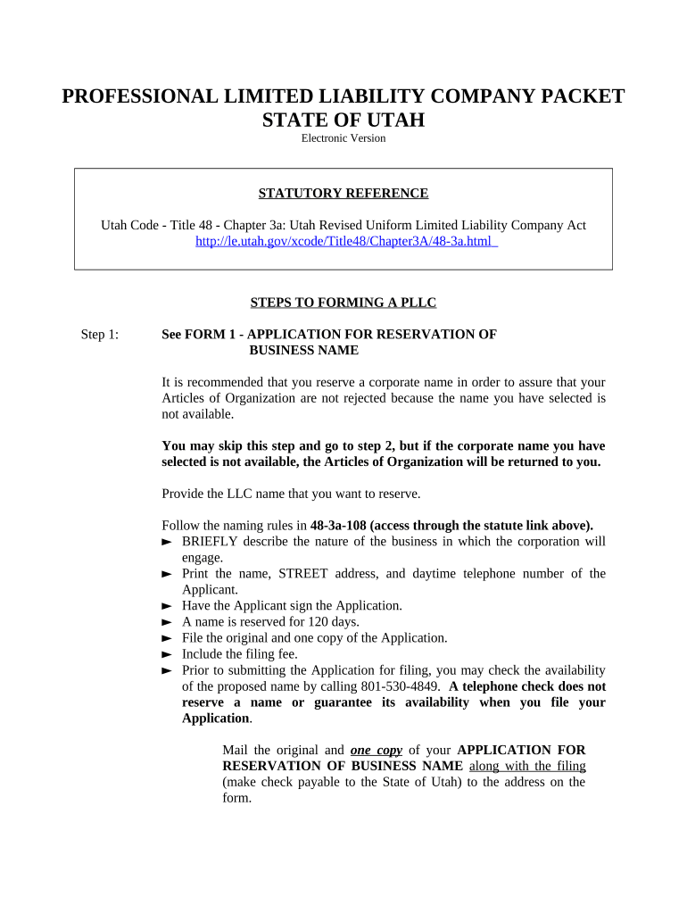
Begin with FORM 1 - Application for Reservation of Business Name. Enter your desired LLC name and ensure it complies with naming rules outlined in the Utah Code. Provide a brief description of your business, along with your contact details, and sign the application.
Proceed to FORM 2 - Articles of Organization. Fill in the required information about your LLC, including its purpose and registered agent details. Ensure all fields are completed accurately.
File the original and one copy of the Articles of Organization along with the filing fee. Use our platform to easily upload and send these documents.
Complete FORM 4 - Sample Operating Agreement by filling in necessary details about management structure and member contributions.
Finally, apply for a Federal Tax Identification Number using form SS-4, which can also be managed through our platform for convenience.
Start using our platform today to streamline your Utah formation process for free!
Utah formation mapUtah formation wikipediaUtah formation notesGeological formations listWhat is a formation in geologyUtah rock formationsHow was the Delicate Arch formedUtah rock formations map
Security and compliance
At DocHub, your data security is our priority. We follow HIPAA, SOC2, GDPR, and other standards, so you can work on your documents with confidence.
It highlights Maple Canyon, about 20 miles northwest of Ephraim; this unique conglomerate rock formation is very popular with rock climbers from all over theRead more
The Uinta Mountains were first uplifted approximately 60 to 65 million years ago when compressional forces created a buckle in the earths crust, called anRead more
Jan 27, 2020 The older rocks of the Morrison Formation preserve a fauna of dinosaurs distinct from the iconic younger Morrison Formation faunas that includeRead more
Cookie consent notice
This site uses cookies to enhance site navigation and personalize your experience.
By using this site you agree to our use of cookies as described in our Privacy Notice.
You can modify your selections by visiting our Cookie and Advertising Notice.